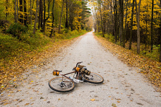
The night was cold and at first I didn't want to leave my sleeping bag. But once I got up, I realized that I was actually warmer when packing up the tent than lying in the bag. This gave me some extra motivation to get going.
Once everything was packed up, I made a quick meal. Some instant oatmeal always works well for me. And since this was the first field test of my alcohol stove, I must say I was quite impressed. This thing is tiny and weighs little, boils a cup of water in about 4 minutes and is completely silent.
I left the campsite at 8:30am, which is quite late by my standards, and rode west, towards Poultney. This place used to be a college town but after closing of Green Mountain College earlier this year, it's probably a bit quieter right now.
Green Mountain College, Main Hall
I kept going west and soon I left Vermont, entering New York and the town of Whitehall. I noticed a small number of Shaker homesteads on both sides of Route 18. It's always nice seeing these people on road, riding their horse-drawn wagons. Unlike speeding drivers, they always wave their hands, saying hello. Somehow I feel that the slow way of traveling by bicycle is in some sense compatible with their slow way of life.
Whitehall, NY
From Whitehall, I made my way north to cross a small bridge and enter Vermont again. My goal was to ride several miles along Poultney River by means of Bay Rd. I discovered this place by accident while browsing Google Maps. It turns out that the full length of Bay Rd has a Street View available so you can take a look and see what it looks like.
The first (southern) section of Bay Rd was muddy but didn't look too bad.
And it looks great. Well, actually, it looked great... back in 2012. The one thing I didn't realize soon enough was that Street View was dated 2012 and apparently things have changed quite a bit in the next 7 years. The slow-moving Poultney River is still there, same with thousands of birds and widespread wetlands. What's gone though, is road's sandy surface, now replaced by mud and hundreds of flooded craters.
But the further north I went, the worse it got, being completely flooded, edge-to-edge, in most places.
Essentially, the entire length of Bay Rd, running alongside the river, is a wet mud-bath. There are very few and very short rideable sections. Most of the road is either flooded edge-to-edge or extremely muddy. Not wanting to risk being stuck in the middle of a giant puddle, I decided against riding through the middle of all of it. I had to go around, but the only way around was through the bushes on either side of the road. Unfortunately, these bushes carry thousands of burs - the type of seeds that have hooks. Very quickly my socks, shorts and shirt were completely covered in burs. Not fun!
After a nearly 2-hour-long struggle, I finally go to the end of this mess and the intersection with Cogman Rd. From there, things were much better.
Next, I basically rode straight north, staying as close to Lake Champlain as possible. Things got a bit tricky once Stony Pond Rd turned into Singing Cedars Rd. Technically, these two are not connected and there is a "dead end" sign, warning you that you won't be able to drive through. But being on the bike I learned that "dead ends" can often be ignored.
And I was right. Once I ran out of the "regular" unpaved road, I found a narrow maintenance road through the forest, running under the old power line. It was in a surprisingly decent shape and let me connect with Singing Cedars Rd with ease.
At that point I realized that my breakfast was a long time ago and all that walking through bushes and mud made me very hungry. Fortunately, Buxton's Store in Orwell came to the rescue. Their sandwiches are yummy, although I had to wait much longer for one to be made for me, than it took me to actually eat it.
International Paper Company, as seen across the lake.
A good portion of my route turned out to run where Champlain Bikeway is, but don't be fooled. There is no dedicated bike path there - just a few signs marking it. You still have to share roads with cars.
Lake Champlain Bridge to NY State.
As I mentioned earlier, I started my ride a bit late in the day for my standards, which combined with shorter days in late October meant I didn't have much available daylight left. I kept pedaling but decided to skip some places I originally planned on visiting, namely Fort Crown Point, just across the bridge in New York and the D.A.R. State Park nearby.
I arrived at my car just at sunset, around 6:15pm. From there, I still had a long, 3.5hrs drive back to Boston.
The whole mini tour was a great experience as for the first time I had a chance to try something like that late in the season. If only there was more daylight left in the day, you could keep going further and further.


