Monday, August 12, 2019

Cardigan Mountain and Northern Rail Trail (S36O) - Day 2


The next day, I got up around 6:15am and was ready to leave the campground at 7. I was a bit more optimistic about that day since I knew it was going to be all downhill (or at least flat) once I cross the Cardigan Mountain. I expected crossing this mountain to be difficult. What I didn't know was the mess I was putting myself into.

It all started easy - Halls Brook Rd from Rumney to North Groton is nicely paved and was actually fun to ride, despite the fact that it was all uphill at a steady 5-8% grade. After reaching North Groton my original plan was to take Edgar Albert Rd, which theoretically (on the map) should connect to Coolidge Rd on the other side of the mountain. But the entrance to Edgar Albert Rd was marked with a dead end sign. Knowing my luck from the day before, I decided it wasn't worth chancing it and I took the main North Groton Rd all the way down to Groton. This was actually fun! It's a 5km (3mi) mad downhill ride that will truly test your brakes.

My decision turned out to be a good one because it meant I had to pass by the Sculptured Rocks - a geological park I have never heard about before. It's a great place to visit. Fascinating how a running water can erode and shape rocks over thousands of years.

The next section of my route was meant to be difficult. It turned out to be a real hell. It all started with a warning just at the entrance to Orange Rd.
To be honest, I didn't even know there were roads categorized as Class 6 so I wasn't sure what to expect, except that it was likely going to be bad. And it was bad - like a very, very rough and rocky, ATV-only trail. I ended up pushing my bike up a lot. Trying to ride up the hill on such surface makes little sense. I would get more tired fighting my way uphill on a bike, than by simply walking.
Then about 2km (1.2mi) up the hill, it got worse. Much worse! There was no road anymore, only an extremely eroded snowmobile trail. I didn't think about taking any pictures of this section, simply trying to finally make it through, but if you can imagine what a snowmobile trail may look like in higher mountains, think of a narrow "road", resembling a small canyon made by running water from melting snow, with millions of boulders thrown all over the place. There was simply no way to ride a bike there - no matter uphill or downhill. I pushed the bike up, carried it wherever required, until after 5km (3mi) of walking I finally reached the summit.
An old stove? Not something you'd expect to find literally in the middle of nowhere in the forest.

I was exhausted. It was still relatively early in the morning, which meant the deep forest was humid. My cap and shirt were completely soaked from sweat. Then out in the open where the air felt a bit drier and I could catch some mild breeze, the sun was scorching my head immediately. The only solution was to keep going and get off this bloody mountain as soon as possible.

Of course, this meant I had to then ride downhill and I was afraid that if my road down looked exactly the same as the road up, I wouldn't be able to ride it at all and will need to now carry my bike for the next 3 miles. Fortunately, and to my pleasant surprise, the road from the summit to the town of Orange was very decent, not counting a few sections damaged by erosion. I made it back to Canaan in no time.

This all means that if you want to visit Cardigan Mountain State Forest, use New Colony Rd from the south and forget about Orange Rd in the north. While it's technically possible to cross the mountain that way (as I did), it's absolutely not worth it.
In Canaan I resupplied again, rested for a while and entered the easiest part of me entire route - the Northern Rail Trail, which stretches all the way from Lebanon to Boscawen (93km or 58mi). Of course, being a former railway, it's all flat. I could finally pick up some speed and keep going.
I have to admit, the trail is really nice. Its surface changes from black gravel to crushed stone to compacted dirt. It's a double track in some places to turn into a single track running through a narrow canyons carved in rocks in others.
I was moving fairly quickly and reached Danbury to stop at their country store for some lunch. One Reuben sandwich later I was back on the road. It started raining lightly but it didn't bother me at all. In fact, that meant the sun stayed behind the clouds and temperature dropped a bit.

After nearly 9hrs I finally reached my car in Boscawen and could pack things up and head back home.

I certainly learned some things on this trip. First, I need to plan my routes differently. Too often I end up in some weird places on snowmobile-only trails that are inaccessible to bicycles at all. Second, I really need to correct for the fact that in a hilly terrain 150km (93mi) in one day is just way too much (and that's what I ended up doing on the first day).

Cardigan Mountain and Northern Rail Trail (S36O) - Day 1

It's really all about time.

Recently, Russ from Path Less Pedaled asked what "What is keeping you from going bike touring?". For me it's time - or the lack of it to be precise. As the owner of two mini humans in a very early school age, I simply can't leave everything behind and go for a bike trip, even a short one. First, I need to negotiate terms with my wife.

Anyway, the rare opportunity happened last Friday so I packed my stuff, put it on the bike and went to New Hampshire for a S36O (sub-36hrs overnight) tour.
I tried a little bit different setup this time. I used a Teardrop canvas bag from Bags By Bird and two Big M.U.T. fork bags from Randi Jo Fab. It worked really well. Those Big M.U.Ts are spacious enough to contain my tent (except the poles), Tyvek foot print, air mattress and the sleeping bag. They also proved to be stable enough to never swivel into the turning wheel, even on the most bumpy roads. The Teardrop kept my camera, tripod, batteries, snacks and other items secure.
I drove up north to Boscawen, NH where I left my car at a Park&Ride lot. This is also the trail head of the Northern Rail Trail that I would be taking on my return the next day - more on that later.
The first miles were easy. I moved quickly and made my way to Contoocook and briefly stopped at the old rail depot. Next, I rode northwest and reached Waterloo Covered Bridge, which reminded me of the time when I visited this place years ago, riding my own Kearsarge Klassic.
Just like years ago, I followed North Rd along Stevens Brook and reached Sutton and then New London. Very soon I discovered that Star Lake Rd is private and what's worse, gated. There was a sign though, stating that bicycling is allowed so I proceed through the automatic gate and kept going. Soon, the road became rough and unpaved, only to soon disappear (sort of).
I made it through and next reached Grafton Pond. At this point it was already afternoon, humid morning air was gone and sun was high up in the sky. It felt way too hot to ride a bike. My water bottles were nearly empty. I reached Canaan and stopped at the convenience store to resupply. Riding in heat and on constantly rolling hills wore me out. I was tired. Little I knew, the worst part was still ahead of me.

My destination for the day was Rumney - a small town just at the edge of White Mountains. Getting there from Canaan is easy - just follow Rt 118 north. But easy wasn't in my dictionary since I wanted to stay off the main, paved roads. So I took Fernwood Farm Rd instead and then tried Bob Porter Rd directing me towards Mascoma River Wildlife Mgt. Area. It all started well - the road was nice and flat...
...but soon turned into a rocky mess.
The worst however was yet to come. First I found a gate with a warning against bears in the area and a "no bicycles" sign. Then, I found out that the section of the road that was supposed to take me north didn't exist in the real life.
I had two choices - keep pushing through what looked like a snowmobile trail, heavily taken over by lots of vegetation or go back. Trying to cross the wildlife management area was not only technically illegal, but also risky - not just because of bears but simply because I had no idea what kind of trails or roads were ahead of me, which meant I could've been stuck there for a long time.

This, and the fact that it was already late in the afternoon and I was tired of riding thousands of hills and the scorching sun, I decided to ride back. For the rest of my ride I stuck to Rt 118 and made my way to Rumney fairly quickly.

I've never been to Rumney before, but I knew there were at least 2 decent-looking camping options nearby: Mountain Pines Campground (conveniently placed right at the bank of Baker River) and Barn Door (a hostel with some camping spots in the backyard). Both were only about $10/night, which meant I was happy to pay the price and have access to a hot shower, rather than try to wild camp somewhere.

Another great thing about Rumney is The Common Cafe and Tavern - great place if you're hungry. They serve good burgers and some great looking pizzas. Live music is a plus too.
When I was done with my dinner it was already dark and it cooled down a lot. I guess I forgot that temperature can drop quite a bit closer to mountains. I felt better after filling my stomach but was ready to call it a day and go to sleep. The next day was supposed to be easier, except the strenuous climb early in the morning, so I needed all my energy back.

Monday, July 29, 2019

Humid mornings and deer flies - The Rockingham Rec Trail revisited

This summer has just hit its halftime and unlike the mad heatwaves they suffer from now in Europe, our summer weather has so far been predictable. Same old story - so humid in the mornings that your shirt gets immediately glued to your back, too hot in the afternoons to sit outside and if you think you could cool down a bit in a shade of forest, you can be sure a battalion of ticks, mosquitoes and deer flies will mount a welcoming committee. Lovely.

Anyway, yesterday I decided to revisit some places in Southern New Hampshire, namely the Rockingham Recreational Trail. If this name sounds familiar, it's maybe because only 2 months ago I wrote about my last ride there. However, that was the northern part of the trail, the one that stretches from Manchester to Newfields. But Rockingham Rec Trail has also its southern section that runs from Windham to Epping, where it merges with the northern route. On the map it looks like these are two completely different rail trails, yet somehow they both share the same name. Strange.

The only time I tried to ride a part of the southern route was 2 years ago when I rode my bike to the Pawtuckaway State Park for a quick S24O camp-out. I remembered well that the trail was though to ride - portion of it was severely eroded by horses hooves and then the other part was too sandy to be usable for cycling.

However, this time I brought a very different bike with me. Instead of 35mm wide tires I roll now on 2.2 inches of rubber. That helps a lot with gaining some traction in deeper sand so I was hoping that I can make it through.
I started at Windham, at the old rail depot where two rail trails begin - the paved Windham Rail Trail runs right across and the hidden, unpaved Rockingham Rec Trail can be found between the trees to your left.

It all began well, except that the route very quickly got really sandy, just as I expected. The section from Windham to Main St in Fremont is often used by ATVs and motocross bikes. This means the surface was eroded, rough and covered with a deep layer of loose sand. There were places where my wide tires got severely slowed down and sunk into the sand. I can't picture riding there on anything else than a mountain bike. Maybe that's why I didn't meet a single cyclist on the way.


On top of that, there was a silly problem with humidity. Humid morning air combined with dust and sand picked up by my bike's tires meant that soon my bike and water bottles were covered with a layer of sticky, grey mud. Not a big deal, unless you want to take a sip of water and suddenly find sand in your mouth.
 

After a longer while I got to Sandown for a quick stop at the old rail depot, then continued along the trail to Fremont. Here, the ATV-segment ended and I entered a section that gets frequently used by people horseback. Soon enough I was already at the end of the Rockingham Rec Trail in Epping, at which point I had to start riding back.
Of course, being me, I didn't just want to use the main road but to be more adventurous. As it turned out, Shirking Rd in Fremont was certainly for the adventurous types. Being a logging road, it was as rough as you can possibly imagine - muddy, uneven, flooded in multiple places. I had to walk through several giant puddles, slide on mud and fight swarms of deer flies and mosquitoes.

Once I made it through I had enough of such adventure and decided to just stick to paved roads and make my way south. The sun was already high up in the sky and day was getting hotter. I stopped at the gas station in Hampstead to resupply and kept going. The rest of the route was a bit boring - just going through some remote cul-de-sacks in Windham - places where I certainly wouldn't want to live. It still surprises me how many Americans think such homes are "great for families with children". Nothing beats having to drive your kids everywhere, I guess.

Anyway, after 4hrs of riding I could drive back home, then cool myself down with a pint of local brew.

Thursday, July 25, 2019

Could you sell everything and live traveling constantly?

Have you ever dreamed of being able to travel constantly? Not being tied down to one place but able to explore the world, meet people, see places? In today's world this certainly isn't an easy endeavor. Our society is no longer nomadic. We are now "designed" to live in one area for most of our lives. But there are some who try. Recently, I found out a video by Jesse Carlsson and Sarah Hammond who decided to sell everything they had and live off bikes, year-round.
It may sounds easy at first but once you realize this means selling your house, car, quitting your desk job and turning truly nomadic, I'm guessing very few of us would be serious enough to attempt it. Clearly, such lifestyle isn't for everyone.
 
First of all, most people who are nomadic are young individuals in their 30s. Then, they are either single or in a relationship but have no kids. Very rarely I hear about whole families with little children who live this way. Third, it's pretty much given that modern-day nomads have professions that allow them to work remotely, as much as possible.

But Jesse and Sarah point also out something else - the idea of downsizing. Essentially, the question whether we really need all the stuff we gather on daily basis. Honestly, do you really need a 4000 sq ft house? Or three cars? As Jesse says in the video - it's better to experience things than have them.
 
Unfortunately, I feel that our American culture nearly prevents this. Years ago I worked with a Canadian and I remember him saying "In America people work for money, to have things. In Canada we work for the weekend". Whether this is true to most Canadians, I have no idea. But many Americans I know don't understand that rather than working 5 days a week for more money, I would work 4 days a week for less. Three-day weekends - what's not to like?

As much as I think about it, being a modern-day nomad isn't really for me. While I would love to have more free time and travel more by bike, I know that once a while I would like to come back to a place called home - however small it would be.
 
Finally, as some people pointed out in comments to this video, Jesse's and Sarah's lifestyle is a luxury and especially a luxurious concept for the poorer part of the population. Most people don't own much, are tied to one place working in order to survive and can't afford wasting time for travel. Being as free as Jesse and Sarah are, is something nearly unheard of in most parts of the world.

Monday, June 24, 2019

Around Ipswich


Summer is officially here. Around Boston, this means three things: hot weather, humid air and frequent thunderstorms. Fortunately, this wasn't the case last weekend. While it was very warm, the sticky, humid air mass hasn't arrived yet and we could really enjoy the time spent outside.

On Sunday morning I decided to visit (and revisit) some places at the shore. I usually take my bike somewhere into the forest, as this is a place where I can easily find some unpaved roads and trails. But this time my route took me all around the town of Ipswich, to the beach and back.


I left early, around 6:30am and at that time air was still cool and pleasant. While it may not be easy to wake up at dawn, it's sometimes the only way to ride in the summer and stay cool. Once we get the usual July humidity here, already around 9am is too hot to ride.
I parked in Topsfield and took Topsfield Linear Common - a rail trail, south. The trail isn't particularly exciting - just an unpaved path with forest on both sides. But soon I reached the northern end of Grand Wenham Canal and that turned out to be a really nice place to explore. There is a small bridge that you can take to the other side but that soon turned out to be a mistake. The path along the eastern side of the canal is flooded in places. Only the western side is passable.
 The canal was a home of geese and ducks - including some inflatable ones:
Once I reached the end of the canal, I entered Wenham and continued along Route 1A towards the shore. At this point I realized how different this route is from what I'm typically used to. Usually, I end up on some rough and rocky trails, often riding through several steep hills. These things definitely slow me down a lot. This time however, I was flying with an average speed of over 15mph (25km/h), despite riding on a (relatively) heavy bike. All thanks to flat (see the elevation profile) and well-paved road. I guess I forgot what a dramatic difference this makes.

All this means that by 8am I was already at the shore. Here is when I realized that access to Crane Beach isn't free, it costs $30 per car. I decided to ignore that and the gate to my right and try an unmarked gravel road going southeast.
This was one the maintenance road I think, but it ended at a small pier where I had a chance to pause for a minute.
Next, I went back to the Castle Hill Estate. I visited this place earlier with my family so I didn't spend much time at the castle. Instead, I rode my bike to the beach. Fatbike mode on!
Well, alright. That didn't exactly work well. My bike isn't suitable to ride on a deep, loose sand so I didn't really ride on the beach. But the place was still nice - quiet, peaceful, with morning sun illuminating Ipswich Bay.
Since it was still early in the morning, I figured I could ride all the way to Little Neck - a small village on the other side of Ipswich River. To do that, I had to ride back to Ipswich first. I really hated taking the main road (Argilla Rd) so I opted for a smaller one that looked good on the map. Unfortunately, that road (Labor In Vain Rd) turned out to be private (and a part of a gated community). If you ride your bike there do it at your own risk and consider yourself warned.

The ride to Great Neck and Little Neck was simple enough - just follow the main road and stay close to the shore. Both places are your typical New England coastline villages. I think people live there mainly to be on the beach the whole time. At the same time, since both places rise above the sea level quite a bit, there are some nice views from the road overlooking Ipswich Bay.

I got back to Ipswich, which was by now in a full-swing Sunday breakfast more, with many of it's citizens and visitors crowding the downtown. I didn't stop though, but continued north. There, at the intersection of Rt133 and Mile Ln is Clam Box of Ipswich - probably the best seafood place on the North Shore. But since it was way too early for lunch, I was soon on my way.
Next, I entered Willowdale State Forest, which has a nice network of unpaved trails - pretty fun to ride as they aren't too rough so you can pick up some speed. That is - if you don't run into people horseback, as I did.

My plan was to slowly make my way back but cut across the trails in Ipswich River Wildlife Refuge. Unfortunately (or perhaps fortunately - for the sake of wildlife), I found out that this entire area is closed to bicycles, so I had no choice but to go around and take Perkins Row Rd instead.

After 4.5hrs on the road, I was back at my car in Topsfield. Now I wonder what other places nearby at the shore are here that I haven't visited yet.

Oh, and I'm currently testing my new handlebar bag - Teardrop by BXB (Bags By Bird). It doesn't need a rack or basket support, fits my whole camera gear and is made in USA. But more on that later.

Thursday, June 13, 2019

Analog's 4x4 Ride - bikes, beer and a good company

I ride alone. I always ride alone. Maybe it's because I don't know many people around my area who would be interested in the type of rides I usually do. But maybe it's just because when I'm on my bike I want to disconnect from everything and everyone.

Then, earlier this year when Analog Cycles announced their first organized off-road bike ride through some remote places in Vermont, something clicked and I got a feeling that I should give it a try. I registered with no hesitation and started impatiently waiting for the day to come.

To be honest, the only thing I was a bit worried or even afraid of was the weather. Don't get me wrong, I cycled in all types of weather. It's just some weather is better than other and, to be fair, swimming in mud, axle-deep, or riding in pouring rain, is not exactly my type of fun. Sure, it could be "fun" for some time but you probably won't truly enjoy 8 hours and 40 miles of it, would you?

But, the weather was perfect. Well..., almost. It was maybe too sunny for my taste. Nevertheless, that's not something to complain about.
So who and what is Analog Cycles? It's a tiny bike shop well-hidden deep in forest in the village of East Poultney, VT - not too far from NY state border. The owners, James and Candice, are from the area but spent years living in different places in U.S. before returning to their roots. As they admitted, there aren't enough locals who would be interested in custom-made off-road bikes, boutique brands and hand-made things. They exist primarily thanks to the Internet. In fact, they ship pretty much worldwide.
The day of the ride started really early for me. I had to wake up at 5am, then drive 3.5hrs across MA, NH and VT to reach East Poultney. When I arrived, well before the scheduled start time, the grounds around the shop were filled with bikes scattered all around and people getting ready and making their morning coffee. Many folks came the night before and stayed over.
Many bikes arrived clean, only to soon get dirty. Some bikes were already dirty, since why clean them if they get dirty again?
We finally set off at 10am. We picked up a good tempo, starting with an easy roll on some flat, wide gravel roads. The first climb came at about 5 mile mark, at which point the whole group stretched out quite a bit. I guess everyone found own pace because pretty soon we were riding in at least two separate groups - one leading in the front and one partying in the back.
We made a quick stop at the top of the hill where Pond Hill Ranch is located, planning on waiting for the second group. Since they were nowhere to be found, we decided to be good friends and leave them behind. The next section ahead was a fast downhill towards Route 4A.

The second group finally caught up with us at the next quick rest stop on Birdseye Rd. We continued together, this time through a very muddy ATV road that I can't even find on the map. Some of us (myself included), decided to stay cautious and don't take any chances. Like I said earlier, memories from the past year were still pretty fresh and this time I certainly wasn't planing on swimming in mud.
Others, however, were much more brave and aimed for the middle of the largest puddle. 
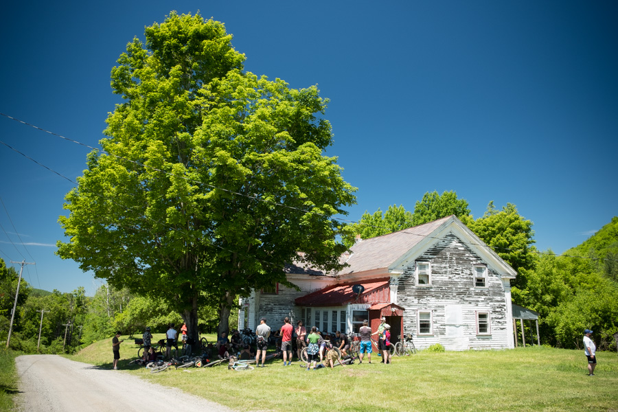
After the next few miles, we finally got to our lunch spot, which turned out to be a large gravel parking lot. We quickly figured out that the shade provided by a nearby large tree is a much more appropriate place to rest. Food and beer was out to be consumed. Bikes were swapped to be tested. Conversations were going and experiences shared.
With restored energy reserves we continued on. More muddy mess awaited, another long and very strenuous climb and finally a very rocky downhill ride. After about 7 hours of riding (including all stops), we arrived at the "swimming hole", ending the ride by cooling off in Poultney River.
The day was slowly coming to an end and it was time to head back to the shop, set up a campfire, pull out all food provisions and start on that keg of a local brew. Some locals decided to head back home but many of us stayed overnight. Analog Cycles provides a ground to camp for free, as long as you ask and behave nicely.

I was actually pretty tired after this eventful day, not from the distance, since 63km (39mi) isn't really challenging, but more from the constant beating by sun. Eventually, I headed over to my tent but I didn't sleep too well. It turned out that I should've packed ear plugs. This way those damn birds wouldn't have woken me up at 4:30am when sun started rising and they decided to give a concert.
I got up at 5am, packed quietly and drove back home. The "Camp Analog Cycles" was empty and silent. Everyone was still sleeping so I didn't have a chance to say goodbye, but I hope to see those people the next year.
Thank you Candice and James for organizing the event! It was a great fun and I certainly would like to see you again soon.